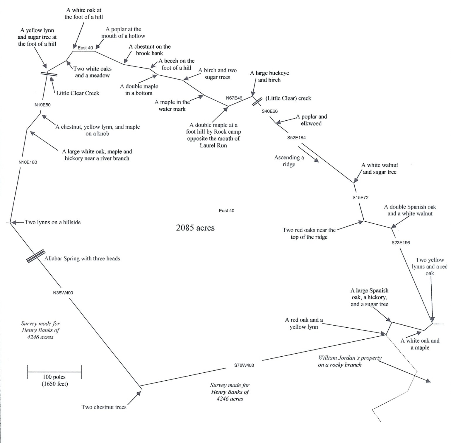
William H. Cavendish and James Jordan–2085 acres in Greenbrier County
on the waters of Little Clear Creek and Laurel Run
Original Land Patent Transcript
Warrant #556 issued December 11, 1793 (446 acres)
Warrant #1021 issued December 25, 1794 (830 acres)
Warrant #158 issued January 24, 1783 (809 acres)
Surveyed April 20, 1796
Signed January 26, 1800, by Gov. James Monroe
Delivered April 30, 1800
Written on the side: “Wm H. Cavendish and James Jordon 2085 acres Greenbrier F. and deliv’d to Col “Jn” White Apr 30th 1800″
James Monroe Esquire Governor of the Commonwealth of Virginia To all to whom these presents shall Come, Greeting Know Ye That by virtue of three warrants to wit, four hundred and forty six acres part of Warrant Number five hundred and fifty six, issued the Eleventh day of December Seventeen hundred and ninety three, Eight hundred and thirty acres, part of Number one thousand and twenty one Issued the twenty fifth day of December Seventeen hundred and ninety four and the residue being eight hundred and nine acres, by part of an Exchanged Warrant Number one hundred and fifty eight issued the twenty fourth of January one thousand seven hundred and eighty three, There is Granted by the said Commonwealth unto William H. Cavendish and James Jordon A Certain tract or parcel of land Containing two thousand and Eighty five acres by Survey bearing date the twentieth day of April one thousand seven hundred and ninety six, lying and being in the County of Greenbrier on the waters of little Clear Creek and Laurell run including the forks of said Creek and Run, and alonge buffaloe lick and Joining the land of Henry Banks and William Jordon and bounded as followeth to wit, beginning at two chestnuts corner to a Survey made for Henry Banks of four thousand two hundred and forty six acres and running with the same North thirty eight degrees West four hundred poles, passing Allabar Spring with three heads at three hundred and twenty poles to two lynns on hillside; and leaving Banks thence North Ten degrees East one hundred and Eighty poles to a large white oak maple and hickory near a branch, North forty degrees East forty poles to a chestnut yellow lynn and maple on a Nob, North Ten degrees East Eighty poles crossing little Clear Creek at Seventy four poles to yellow lynn and sugar tree at foot the hill North sixty degrees East forty poles to two white oaks near the Corner and a meadow, North thirty five degrees East twenty poles to white oak foot hill East forty poles to a poplar at the mouth of hollow South sixty five degrees East fifty eight poles to a chestnut on the Creek bank, South Eighty degrees East fifty poles to beech on foot the hill South fifty four degrees East Eighteen poles to a double maple in a bottom, South Seventy seven degrees East forty eight poles to a burch and two sugar trees, South fifty five degrees East forty eight poles to a maple in the water mark South Sixty five degrees East fifty poles to double maple foot hill by Rock camp, opposite the mouth of laurel run, North sixty seven degrees East forty six poles a large buckeye and birch South forty degrees East Sixty six poles crossing the Creek at ten poles, to poplar and Elkwood, South fifty two degrees East one hundred and Eighty four poles up a ridge to white walnut and sugar tree; South fifteen degrees East seventy two poles to two red oaks near the top of ridge, South Seventy five degrees East fifty two poles to double Spanish oak and white walnut South twenty three degrees East one hundred and ninety six poles to two yellow lynns and red oak corner to William Jordan on the S.East side a rocky branch and runs with the same, thence South fifty degrees West twenty poles to white oak and maple North Seventy five degrees West sixty poles to a large Spanish oak hickory and Sugar tree, and South twenty five degrees West twenty six poles to a red oak and yellow lynn corner to the same and leaving Jordan, and runs with a line of Banks’ Survey of eight hundred and fifteen acres South Seventy eight degrees West four hundred and Sixty eight poles to the beginning with its appurtenances To have and to hold the said tract or parcel of land with its appurtenances to the said William H. Cavendish and James Jordan and their heirs for ever In Witness whereof the said James Monroe Esquire Governor of the Commonwealth of Virginia hath hereunto set his hand and caused the lesser seal of the said Commonwealth to be affixed at Richmond on the twenty sixth day of January in the year of our Lord one thousand eight hundred and of the Commonwealth the twenty fourth.
James Monroe
Source: The Library of Virginia: Virginia Land Office Patents and Grants/Northern Neck Grants and Surveys
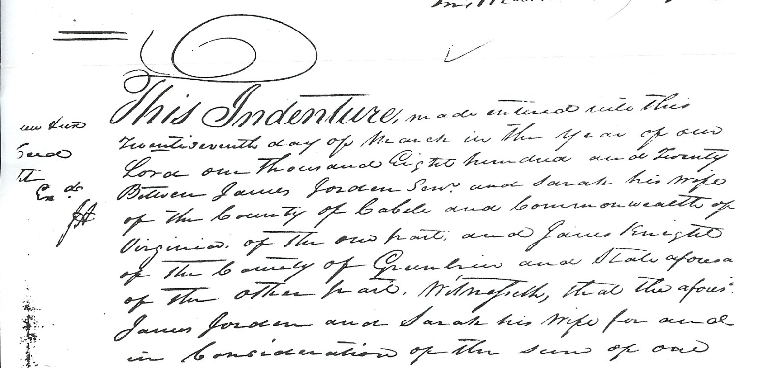
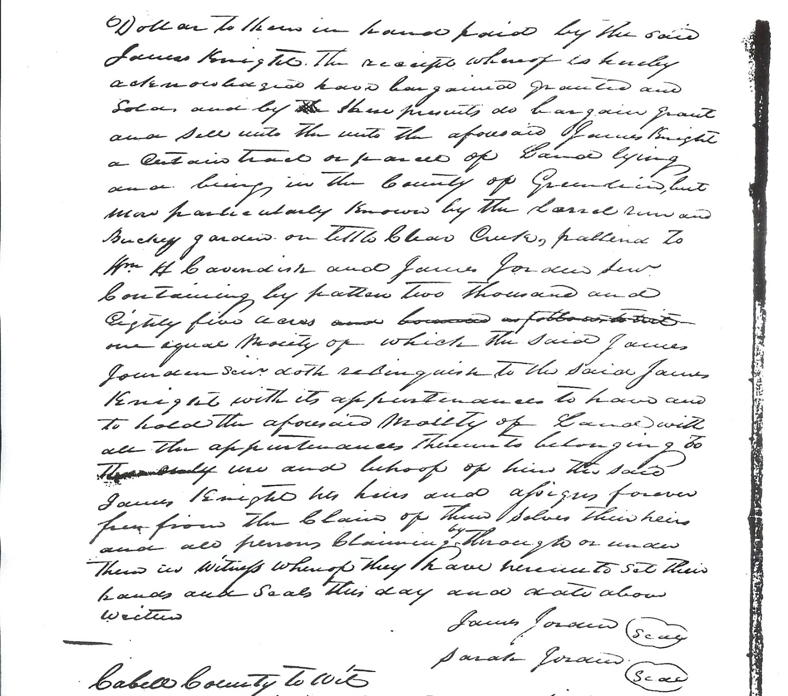
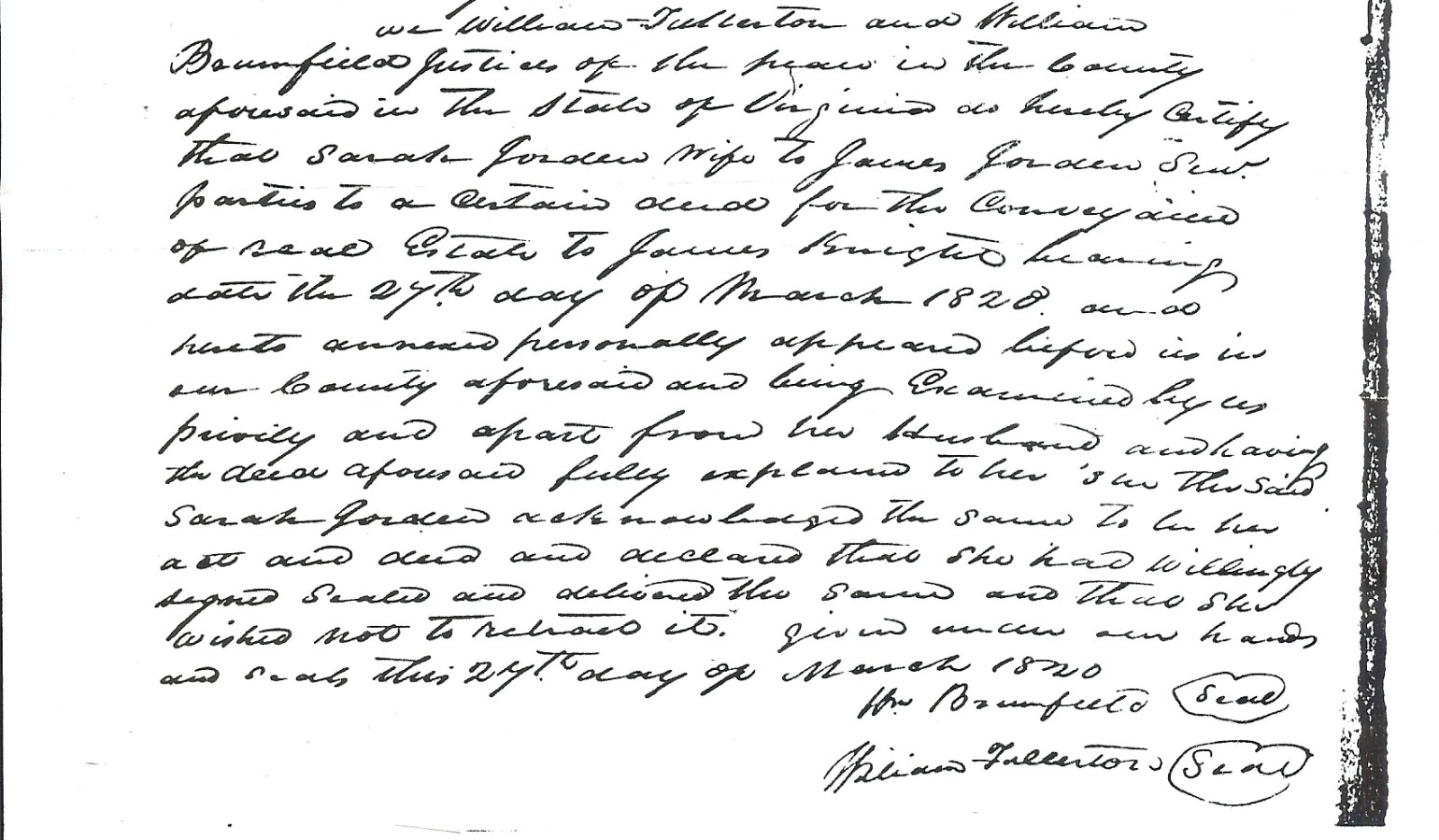
1820 Resale from James and Sarah Jordan to James Knight for $1