in the Williamsburg/Cornstalk area
This slideshow could not be started. Try refreshing the page or viewing it in another browser. Click on a link below to access an image of the original land patent and a detailed plat of its respective survey. These land patents were first-title deeds from the Commonwealth of Virginia establishing the beginning of private ownership of the land. Each patent listed the name(s) of the patentee and any assignees, and contained a description of the survey (in metes and bounds); it also gave the dates of any warrants and noted when the patent was granted. All patents were signed by the Governor of Virginia. I plotted each patent individually from images of the original Northern Neck Land Patents, then patched them together based on landmarks and common survey boundaries. I believe this overlay to be as accurate as possible, given that the surveys have several errors and areas of overlap, probably because they were made by different surveyors over many years.

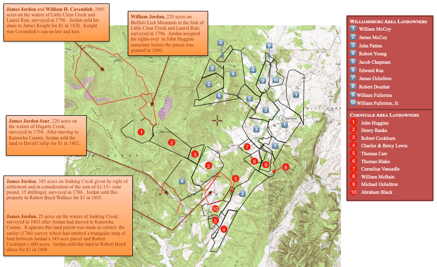

Click the left and right arrows in the presentation above to toggle between Plots Only, Plots on Map, and Map Only. Click on the X in the lower right corner to see the slides in full screen mode.
Jordan Land Holdings
Cornstalk Area Landowners
Williamsburg Area Landowners
Area landowners not included on the plot map above: